Southeast Alaska
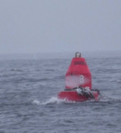 Buoy 8 marks a shallow ledge in Sergius Narrows. The white patch on the buoy is snow and the strands wrapped around it are kelp. The inside route to Sitka involves passing a very narrow section with fast tidal currents called Sergius Narrows. The chart says the currents reach 8 knots. The Coast Pilot notes: At the strength of the current it is not safe for any vessel bound either way…The channel is so narrow and the current so variable in direction that if a vessel gets a sheer she may be carried onto the ledges or shore before she can be straightened out. The channel has a sharp 90 degree turn immediately after the narrows with another rock which needs to be avoided. While there are buoys marking the channel thru Sergius Narrows, the buoys are not lit, and unfamiliar places with rocks and fast currents are best avoided at night. After a gale died down, we left Tenakee Springs before dawn with a good tailwind, some freezing spray and a favorable current. I wanted to go thru Sergius Narrows during daylight, so we motored until well after dark, then threaded our way thru a narrow passage between rocks and an island to anchor half a mile away, with a light wind and clear skies. I was quite concerned about getting the timing right so we’d arrive at slack water, and hopefully without so much wind as to make steering difficult. I carefully planned out when we needed to raise anchor, get out of the bay we were in and get to the narrows for slack water.Naturally, there was a snowstorm the following day! So, instead of going thru Sergius Narrows in the dark with light wind and clear skies, we entered with gusty winds and blowing snow (there was no point in waiting for another day, as the wind was forecast to increase to a gale late in the day). We arrived early, in case slack water arrived earlier than predicted, and held position by steering up into the current and wind (the wind was funnelling down the channel). We had current predictions for Sergius Narrows and for points nearby, so by estimating the speed of the current at a nearby point, I could tell if slack water was going to arrive at the predicted time or not. I steered from outside, in the wind and snow, where the visibility was better. Ten minutes before predicted slack water we headed for Sergius Narrows. At full throttle, we had no problems, and quickly passed thru and into wider, deeper, slower water.
 Just to break up the snow pictures, here is a relatively warm-weather picture. This was taken a few months back, in the Chukchi Sea. We were pushing to get south quickly while we had a favorable wind. I was attempting to pole out the yankee jib (the corner of which is just visible to the right of the mast). If you look closely at the pole on the foremast, you can see that it has just broken away from the mast. The end fitting on the spinnaker pole sheared off and the pole fell into the water. We brought the pole back aboard for later repairs, and continued sailing, without poling out the jib.
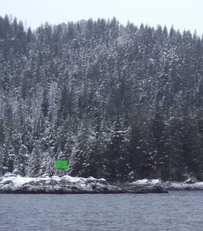 Though it’s called the Inside Passage, some of the waters we’ve sailed recently have been pretty open. Chatham Strait, where we began this leg, is 138 miles long and between 18 and 5 miles wide. Then, after Richard took us through the treacherous narrows of Peril Straight, we crossed the corner of Salisbury Sound, which is open to the sea and to prevailing conditions in the Gulf of Alaska. For us, this meant more strong gusts and wind-driven snow. I took a turn at the tiller as we next entered Neva Strait, where the trees closed in around us, the island sheltered us from the gusts, and the snow wafted gently across the air. Together, Neva and Olga Straits would bring us to the outer waters of Sitka, with an average width of 0.2 miles along the way. The calm was amazing, with lofty walls of evergreen, lacy with snow, so close. Rocks and shallows dot the straits, so you can’t daydream too much, but I imagine I saw reindeer flying ahead of me pulling a sleigh full of treats!
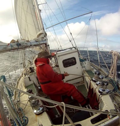
 Maggie steering.
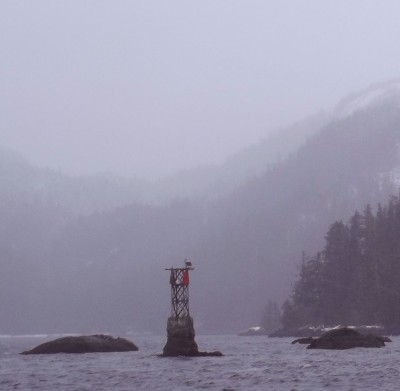 Much easier to pass thru than Sergius Narrows are the nearby Kakul Narrows, which have less current, deep water, no standing waves or sharp turns.
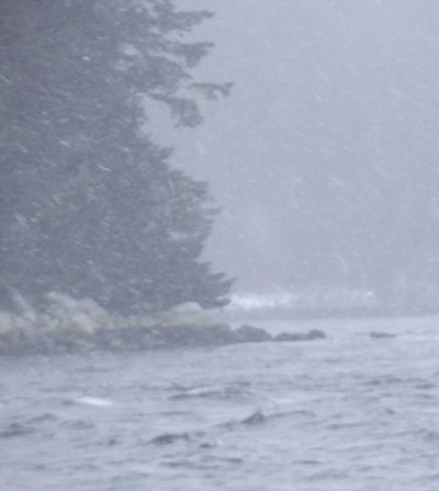 Daylight and no gale make for relatively good traveling conditions.
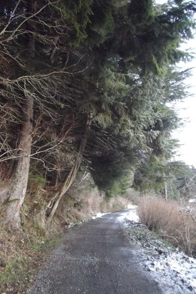 The one and only road in Tenakee Springs is a dirt path hugging the shoreline for about a mile. No cars are allowed, but you may pass a resident on his ATV towing a little trailer holding a deer he just harvested. At the village, buildings line the path, even built on pilings over the tide line. But here, near the boat harbor, spruce trees dominate the way. It’s a small part of the Tongass National Forest which covers most of Southeast Alaska, the largest temperate rainforest in North America, bountiful and beautiful.
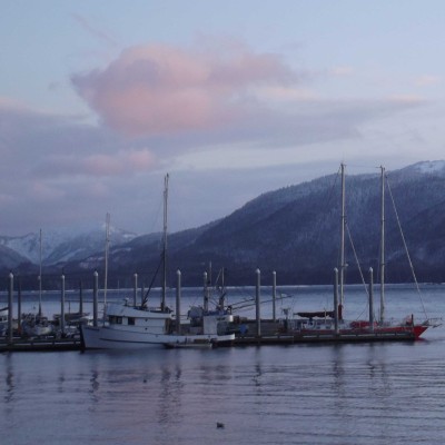 Issuma at the end of the dock.
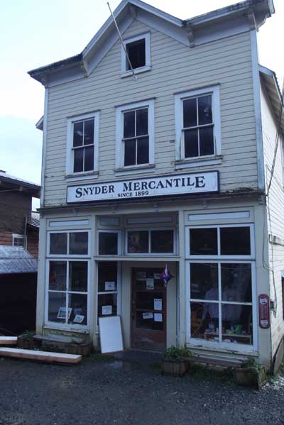 The Snyder Mercantile Shop has been serving basics in Tenakee since 1899, when Ed Snyder rowed over from Juneau with a boat full of groceries and set up business. The building and fixtures inside date back over a century. The old heavy wood display cases offer fresh groceries and modern pharmacy items, with lingering old time wares in their original packaging displayed like a museum on the highest shelves. The hospitality matches the charm. When another customer discovered I�’m from New York City, she called over the young shop clerk to introduce us, who lives in New York City too when she�’s not staying with her uncle in Tenakee. Part time in New York and part time in Alaska, sounds great to me!