Gulf of Alaska, Alaska
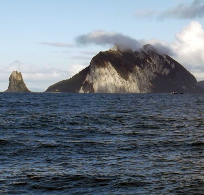 I had a reasonably good weather forecast to leave Kodiak with. There was a big low with storm force winds nearby, forecast to stay far south of me. I wasn’t completely convinced it would do as forecast, so I took a longer route, more around the Gulf of Alaska than straight across it, so I would be able to get shelter somewhere if conditions changed. This is Cape St Elias, at the end of Kayak Island on the eastern side of the Gulf of Alaska. I came close to shore here to use the Iridium satellite phone. The satellite airtime plan I am using is for Alaska and Canada. I didn’t realize when I bought the airtime that the Gulf of Alaska would not be considered Alaska (which is reasonable, if not advertised), I sailed close to Middleton Island (in the middle of the Gulf of Alaska) to use the phone also, but Iridium doesn’t seem to consider Middleton Island to be part of Alaska, so the connections were rejected. Several hours after Cape St Elias, the wind went against me, and I hove-to for most of a day, waiting for the wind to change and catching up on sleep.
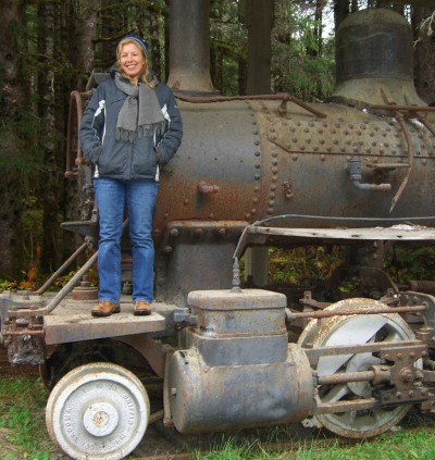 Yakutat is a cannery and sportfishing town in the eastern part of Yakutat Bay. This train was used to haul fish from the cannery along the Yakutat and Southern Railway. Maggie met me in Yakutat to continue the trip south.
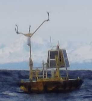 While it looks otherworldly, this buoy transmits weather conditions for use in forecasting. This is called an ODAS (Ocean Data Acquisition System) buoy. I’d been listening to weather conditions from this buoy on the VHF weather channel for a while (wind direction, wind speed, wave height and barometric pressure from these ODAS buoys are reported hourly).
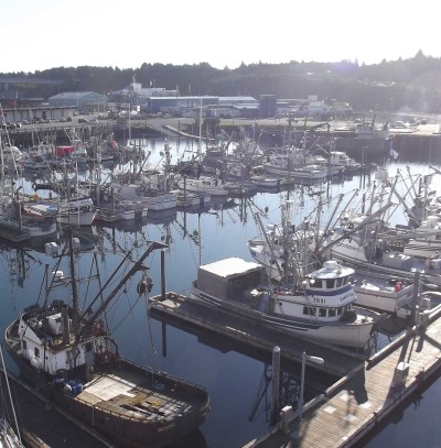 Kodiak is the largest city we’ve been to since leaving Quebec. Kodiak has a big harbor, though it was pretty much full when we arrived, as most of the boats were waiting for a fishing season to open. Pretty much everything one needs is available in Kodiak. The new battery for the Iridium phone didn’t work out. Douglas Pohl of northwestpassage2012.com very kindly lent me an Iridium phone for the rest of the trip. Thanks Douglas!While the weather in Kodiak was quite pleasant, the real stormy season is coming quickly, so it is time to be moving on. On the crew front, Jordan had always said he could stay only until the end of September, so he left the boat in Kodiak. Lin also left the boat in Kodiak. After a couple of busy days in Kodiak, with a reasonable weather forecast for getting across the Gulf of Alaska, Jordan cast off my lines from the dock and I motored out of Kodiak singlehanded again.
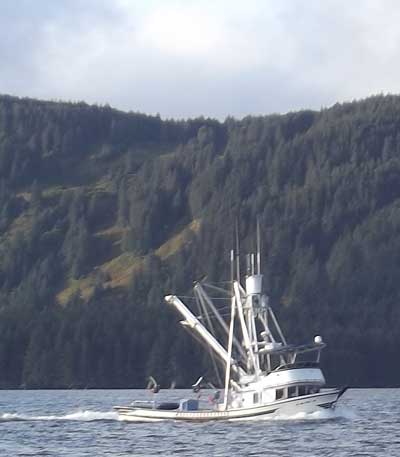 From Chignik we made our way up Shelikof Strait between Kodiak Island and the Alaska Peninsula. With a forecast for moderate headwinds and a current against us, we stopped for a day in the well-sheltered Larsen Bay. There is a village in Larsen Bay of the same name with a winter population of (I think) about 40. The whole area is full of hunting lodges, as Kodiak Island is a great place for bear hunting. The cannery (which had closed for the season) let us tie Issuma alongside their pier to dry out. This let us replace the zincs on the propellers and shafts (they were worn/missing) and scrub the bottom of the hull. We ended up doing this work at night (so no picture of this) because the weather forecast changed and it seemed like we would have good enough weather for leaving the next morning, so didn’t want to be aground during good travelling weather. After the tide floated us, we left the pier and made our way to Kodiak City. To get to Kodiak City from Shelikof Strait one has to get around Whale Island. There are two choices, go south of Whale Island through Whale Pass, or north of it thru Afognak Strait. Whale Pass is the route almost everyone takes–it is marked (has buoys marking the rocks) and it is shorter. Whale Pass also has currents twice as fast as in Afognak Strait, and much more traffic. I wasn’t keen on strong currents, rocks and traffic all at once, so it seemed better to take the unmarked Afognak Strait route instead of Whale Pass. As Issuma has a GPS connected to the computer for chartplotting, and the charts for the area were based on recent surveys (so accurate), I figured it was safe to rely on the GPS and chartplotting software to keep us off the unmarked rocks. So we had a pleasant trip through Afognak Strait towards the end of the day. The fishing boat in the picture passed us as we entered the strait. —