Bering Strait, Alaska
 Sailing past Cape Prince of Wales with a delightfully favorable wind. Cape Prince of Wales is at the end of the Bering Strait. The Northwest Passage runs from Davis Strait in the east to Bering Strait in the west. While we have now completed the Northwest Passage, the difficult part is mostly still ahead–the trip south, late in the year. We had had great northerly winds pretty much since Barrow (North tip of Alaska), which really helped us along our way down the Chukchi Sea and through the Bering Strait. We knew of a southerly gale coming, and hoped we could make it through the Bering Strait before it arrived. It was not at all clear that we could beat the southerly. I made plans for where we could go if the southerly gale arrived before we reached the end of the Bering Strait (most likely plan was to anchor off a low, sandy coast with a bit of protection, prepared to put to sea and heave-to or sail far east to Kotzebue Sound in the lee of the shore if the protection wasn’t good enough). In the end, the arrival of the southerly gale was delayed a bit, and we were fortunately able to get through Bering Strait and sail onto the anchor late in the day in the harbor of Port Clarence, to wait out the gale there. As described in the entry called “Update”, the southerly gale lasted longer than expected, and we were really glad to be inside such a protected harbor, even if we did drag anchor a lot.
Cape Prince of Wales
Reply
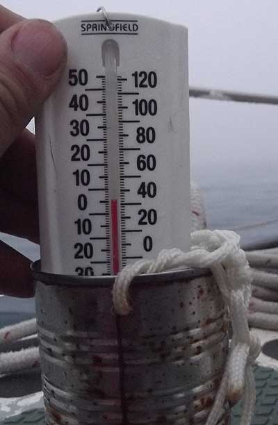 Lin came up with the string on a tin can idea for taking the temperature of the sea water. This is better than trying to drag the thermometer in the sea (it tends to hit the hull on waves) or using a bucket to get the water (if someone makes a mistake and doesn’t haul the bucket up properly the handle tends to break off from the pressure of being dragged behind the boat). Collecting water by throwing a tin can over the side is easy, simple, and if anything goes wrong, there are other tin cans that could be used :). We’ve been taking the sea temperature hourly (for logbook entries) and anytime we are in poor visibility (often) and wondering if ice is nearby. As I see it, a safe speed for being underway is one in which you can avoid hitting any ice you may come across. This depends on visibility (how close the ice is before it is seen) and boat speed. We slow down in poor visibility if we suspect ice is about (in more congested waters than the Chukchi Sea, slowing down in poor visibility is also done to avoid collisions with other vessels). -1 degrees C is the coldest water temperature we’ve seen (sea water freezes at about -1.8 degrees C depending on salinity)–0 degrees C and +1 degrees C have been much more common. For those familiar with boat electronics, yes, a depthsounder with a transducer that measured the sea temperature certainly seems like it would be a nice thing when sailing in cold water :).
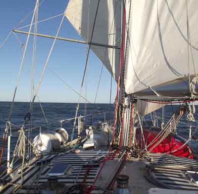 A beautiful day downwind in the Beaufort Sea. The Beaufort Sea is part of the Arctic Ocean, located north of the Northwest Territories, the Yukon, and Alaska and west of Canada’s Arctic islands. The sea is named after British hydrographer Sir Francis Beaufort, who is best known for creating the Beaufort Wind Scale (when winds are described as Force 8, that means 8 on the Beaufort wind scale).
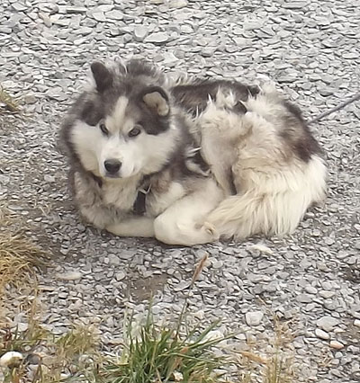 A contented-looking Husky watches the road.
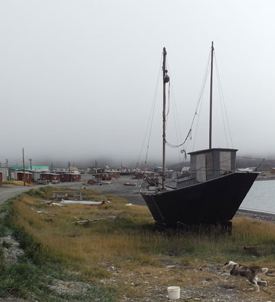 As we sailed in, we noticed what seemed to be a schooner on the beach. After walking into Ulukhaktok, we got a better look at it, and saw it was the ketch Nur. Built of steel plate to what looks like a dory hull design, and rigged with what seemed available locally, we were told the owner was a white man who built the boat here. The owner apparently lives on nearby Holman Island during the summer, so we never met him.
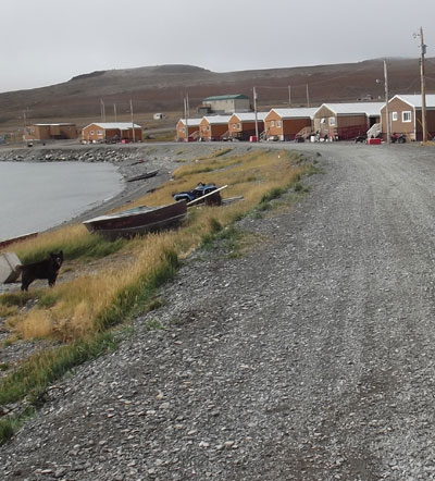 Most of the residents of Ulukhaktok (1986 population 303) seemed to be away somewhere when we were there. We talked to several people, but mostly there seemed to be few people walking around. Perhaps because the most common way of getting around is 4-wheelers (All Terrain Vehicles–the kind you sit on, not in, powered by small engines), so not so much time is spent walking around.Victoria Island is the ancestral homeland of the Copper Inuit, and in the 1900s there were about 300 Inuit in the area, hunting on Bnks Island in the winter and on Victoria Island in the summer. The first Hudson’s Bay Company post (now called the Northern store) in the area was established in 1923 on the north shore of Prince Albert Sound. The post moved to Holman in 1939. In 2006, the name of the hamlet was officially changed to the traditional name of Ulukhaktok.