Shumagin Islands, Alaska
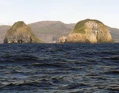 To get from the Bering Sea to the Pacific Ocean, one needs to go thru one of the passes between islands in the Aleutian Islands. There are tidal currents, often strong, in the passes, which result in tide rips, overfalls, and generally choppy water when strong wind opposes the strong tides. I wanted to go thru the nearest pass to Dutch Harbor, Unalga pass, because it is short and scenic. Being short, you are thru it quickly, even if the ride is exciting, one doesn’t need to be concerned about taking so long to get thru that the tide changes and then opposes the wind (causing rough seas). We were not ready to leave Dutch Harbor until late in the afternoon (too busy getting stuff done), and to go thru Unalga pass would have meant going thru at night–where it could be difficult to see the tide rips as there was not much of a moon, or waiting until the next day. The other option was to take the biggest and farthest away pass, Unimak, where the currents are not very strong. Unimak Pass is much longer, so the current would not always be in our favor, but we had light winds forecast, so no concerns about rough seas that night. So we sailed and motored and motorsailed thru the night to Unimak Pass and into the Pacific Ocean. Shortly after getting out of the pass and beyond the pseudo-traffic-lane setup they have there, the wind picked up, and we ended up heaving to for the night in the lee of some reefs, which broke the seas up. The next day we continued sailing. We later hove to near the Shumagin Islands, so we could go thru them in daylight. There was a chance of strong winds funneling between the islands, and we weren’t too sure of the currents, so it seemed best to go thru during daylight. As a result, we got to see The Haystacks. The rocks in the picture are part of The Haystacks, and are located south of the Alaska Peninsula in the Shumagin Islands. I’ll talk more about the routing decision later.
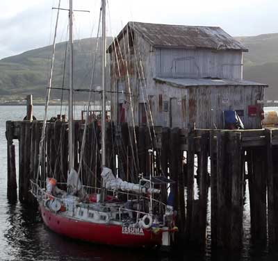 Chignik means ‘strong wind’. While the settlement of Chignik is in a bay (Anchorage Bay) with good shelter from most directions, it is subject to williwaws. It was sad to see the remains of a fibreglass sailboat on the beach. We were told it anchored in the bay one night, a wind came up and drove it ashore.Chignik is basically a cannery settlement–during the off-season–when we arrived, about 70 people live there. We tied up to the cannery dock to take on fuel, refill the propane bottles and use the telephone.
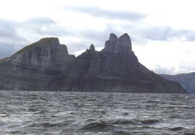 Alternating layers of light and dark colored rock make Castle Cape interesting to look at. We sailed past Castle Cape, then spent much of the night sailing to windward in Force 5-6 winds in Chignik Bay, before heaving to for several hours to wait for daylight to enter Chignik.
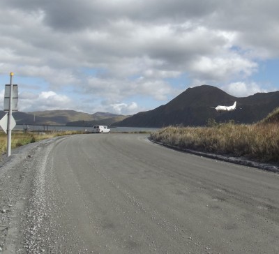 Plane coming in to land at Dutch Harbor airport. The road runs very close to the runway, so traffic must stop when planes are taking off or landing.
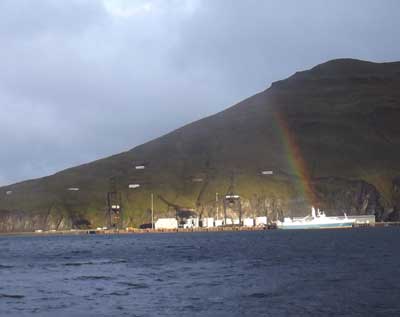 There are a few places to dock in Dutch Harbor. The rainbow and light making its way thru a break in the clouds are illuminating the Spit and the boats docked there. The spit is well protected, and easy to enter, but a long way from the rest of town. The harbormaster had us dock there because there was no room elsewhere. The big fishing season is about to start, so harbors are now full of boats waiting for the season to open.Frequent strong, sudden winds (williwaws) make their way down the slopes of the cliffs in Dutch Harbor. The winds don’t last long–up to fifteen minutes or so, but are strong, and it is nice to be tied to a strong dock when they arrive.
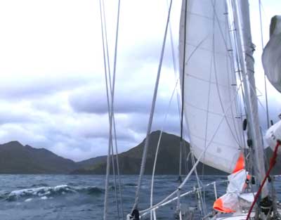 Dutch Harbor is all a rugged mountainous area. Lots of williwaws (wind coming down off the cliffs, suddenly resulting in high winds that last for several minutes) keep things interesting. As we arrived in Dutch Harbor on strong winds, we needed only one small jib to take us into the harbor. The harbormaster called us on the VHF radio as we entered, and told us where to dock.
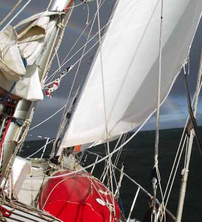 We had great winds when sailing south from St Paul towards Dutch Harbor, as we left anchor just as the gale started to ease. We didn’t need many sails, and made good speed. The rainbow ahead was kind enough to show us the way.
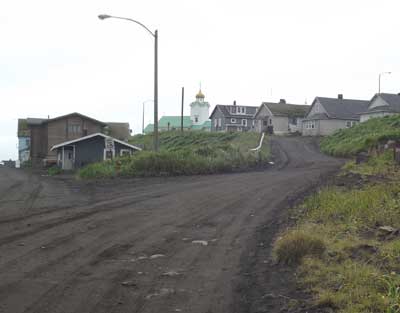 After sitting out the gales in Port Clarence, we had good northerly winds taking us south. We could have made it all the way to Dutch Harbor, but the forecast showed the northerly winds would be a gale by the time we reached Dutch Harbor, and while it looked like a safe entrance in a northerly gale, I hate entering unfamiliar places in gales–there is little room for correcting problems. So we went into the harbor of St Paul, one of the Pribilof Islands, about 230 miles north of the Aleutian islands. The cannery manager was nice to us and let us use their dock for a while. When some fishing boats came in later that night needing to unload, we moved out of the harbor and anchored nearby, in a location protected from the approaching NE gale.St Paul has a church, school, small hospital, weather station, general store and a library with internet access, which was nice. We spent three days sitting out gales in St Paul. After the wind moved from NE towards NW, we moved around to a different spot for better protection from NW. As the gale started to ease, we left, taking advantage of the gale’s strong northerly winds to get us to Dutch Harbor, planning to arrive when the winds were down to Force 7.