Nunavut
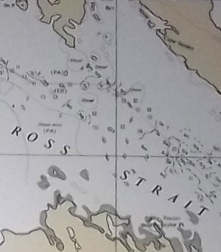 George asked a while back about how we were deciding where to stop. At the time, I was pushing hard to get up the Greenland coast so that if ice forecasts for Canada were good, we would have the opportunity to head towards northern Canada from northern Greenland (there is a warm ocean current going up the west side of Greenland, and a cold current going down the NE side of Canada, so if you want to get to the north of Canada by sailboat, it is best to go there via the west coast of Greenland). So my priorities were to make as few stops as possible in the interests of keeping moving during the short time we had. It was extremely tempting to go into Disko Bay, which is full of icebergs, just to see the spectacle, but we sailed by without stopping because we didn’t have time. When deciding where to stop, we look at things like the expected weather, to see if there will be shelter from it, the possible weather, to see under what conditions we’d need to leave, how complicated the navigation is, can we sail in or do we have to motor, is there likely space to anchor or tie up, if there is a settlement there, what facilities (ie water, fuel, groceries) are there, and what interesting things are there. How complicated the navigation is means things like how many shallow areas/rocks need to be avoided and how difficult are they to identify and avoid and how well are the charts likely to agree with the GPS positions–always something to consider in places not frequently travelled. To give an example of choosing a stop, I really wanted to visit Gjoa Haven. This settlement is named after Roald Amundsen’s Gjoa (the first vessel to go thru the Northwest Passage), which spent two winters in what one of the crew called “the finest little harbor in the world”, so there is a lot of historical interest in going there. There is a community in Gjoa Haven to visit, and we could clear customs, buy fuel (via jerrycans) and food, and have a safe place to leave the boat while we were ashore. Gjoa Haven is also along the best-travelled route through the Northwest Passage, as the shallow waters stop the icebergs, so the waters that need to be sailed to get to Gjoa Haven tend to be free of ice earlier. As we sailed towards Gjoa Haven, a problem became apparant about 100 miles away. The wind was shifting, and it was now dead to windward that we would have to sail for about 50 miles to get through James Ross Strait. The picture shows a portion of the chart for that area. Depths are marked in fathoms (a fathom is six feet), and there are only depths marked in a small area–the rest–white space–has not been surveyed, and is full of unmarked shallow areas. So we were looking at beating dead to windward through a relatively narrow channel. While that alone is not a big problem, the furler for the (yankee) jib had failed, so sailing to windward was more difficult than usual. So we reluctantly bypassed James Ross Strait and our planned stop at Gjoa Haven, and sailed via Victoria Strait instead.
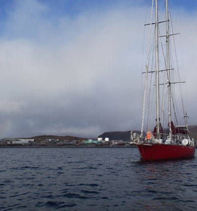 We had a pleasant daysail from Freshwater Bay to Ulukhaktok (formerly Holman). The hamlet sits between two bays, King’s Bay and Queen’s Bay. We had planned to sail into King’s Bay (as mentioned in the Sailing Directions) and anchor, but, on approach, considering that Queen’s Bay was wider, and more feasible to tack into if necessary, we sailed into Queen’s Bay instead. I was apprehensive coming in, as there were only occasional soundings on the chart (the Sailing Directions note that the approaches have not been fully sounded), and I wasn’t sure the features of the land we were looking at matched the chart very well. Sailing onto the anchor went really well, we made it into the bay on one tack, furled all but the mainsail, rounded up into the wind and lowered the anchor, later backing the mainsail to set it. No one noticed us at first, later several people said it was rare to see a sailboat here (though cruise ships commonly visit).
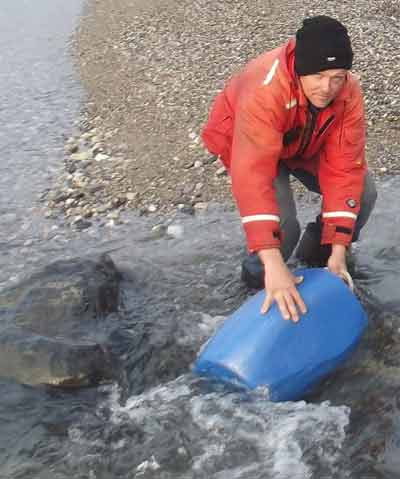 The Sailing Directions for Arctic Canada mention that Freshwater Creek at the head of Freshwater Bay is an excellent source of fresh water. So, as our drinking water supplies were running low, we anchored in Freshwater Bay and rowed the dinghy ashore with the blue water jug. We made several trips with the water jug to fill Issuma’s freshwater tanks. We chlorinated the water (added bleach) to keep stuff from growing in it (a carbon filter near the faucet later removes most of that chlorine). The water does taste good.
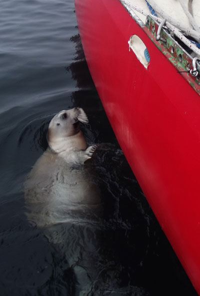 As we sailed slowly in light winds, this seal came over to inspect Issuma’s hull.
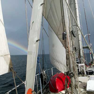 I have been very surprised by the lack of ice this year (not that I’m complaining–the idea of getting stuck in the ice has absolutely no appeal). We have seen hardly any ice since Lancaster Sound. The long range forecasts for this year indicated a slightly later breakup than last year, not nearly so much ice free water. I suppose it is only a difference of a few degrees in average temperature for a few weeks that results in suddenly there being so little ice, and that small a temperature difference being difficult to forecast. The lack of ice makes for pleasant sailing (at times).
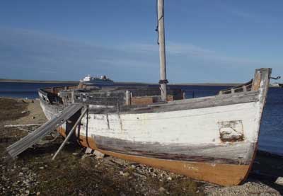 This was once a schooner, but the main mast was removed when the engine was put in. It was towed to Cambridge Bay from Tuktoyaktuk. One of the builders of the church bought the vessel, but was stationed elsewhere when it arrived, and it was never used.
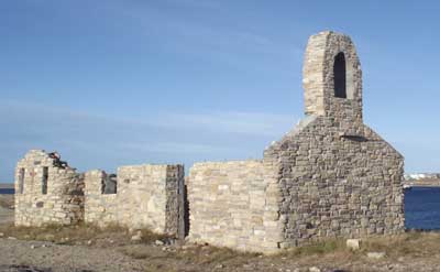 Ruins of the first Catholic Church in Cambridge Bay, built with rocks, seal oil and clay.
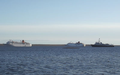 I was surprised by the number of cruise ships visiting Cambridge Bay. There were three on one day when we were there (I’m not sure whether the one on the right is a cruise ship or a yacht, but there was another big cruise ship anchored there earlier in the day). There aren’t always that many cruise ships, but the hamlet does a very good job of promoting tourism. They have a great visitors center/museum, and everyone is pleasant.
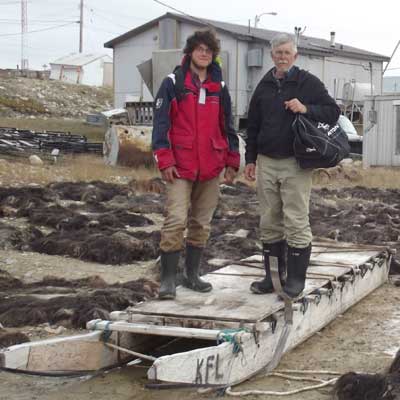 Jordan and Lin standing on a sledge, surrounded by drying muskox hides. We asked around, but didn’t really ever find out what the hides are used for after they are dried. Cambridge Bay is a large hamlet in Arctic Canada, population about 1800. It was named after the Duke of Cambridge by Warren Dease and Thomas Simpson of the Hudson’s bay Company in 1839. The area had been an important Inuit camp-site for many years because it had plentiful caribou, seal, fish and birds. The permanent settlement was established in 1955 when a DEW (Distant Early Warning–a line of radar stations setup in northern Canada during the Cold War) line station was put there. It is now an Arctic adminstration, transportation, tourism and supply center. We cleared into Canada in Cambridge Bay with the assistance of the RCMP (police), who were extremely helpful and hospitable. In fact, everyone in Cambridge Bay was pleasant and helpful. We arrived too late in the year to buy any musxkox or caribou meat (next harvest starts soon) at the store, but did try the muskox burgers in the hotel, which were very good.
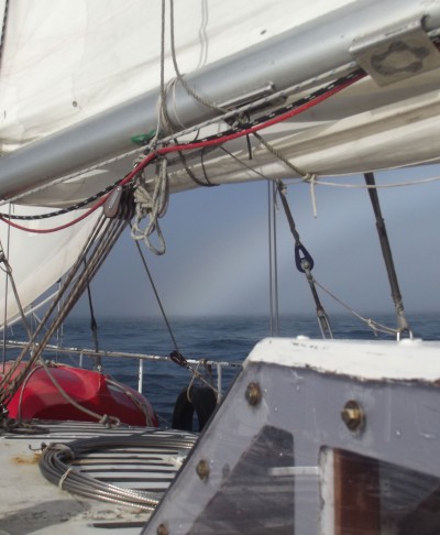 We often sail in the fog. I guess this is really a rainbow obscured by fog.